


Local News
Ridging keeps weather pleasant, but what does “ridging” mean?
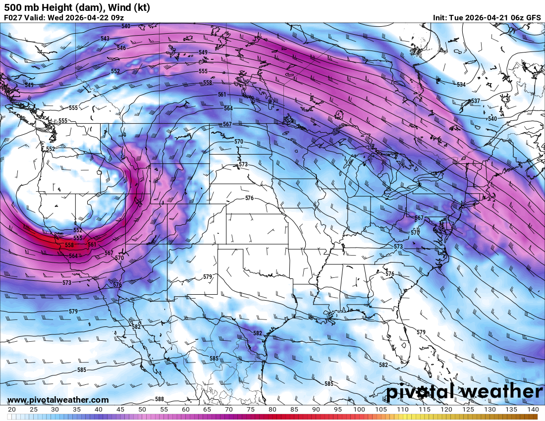
Ridging in the mid level jet stream is continuing to provide quiet weather over the majority of the US today and into midweek.
But what does mid level ridging mean?
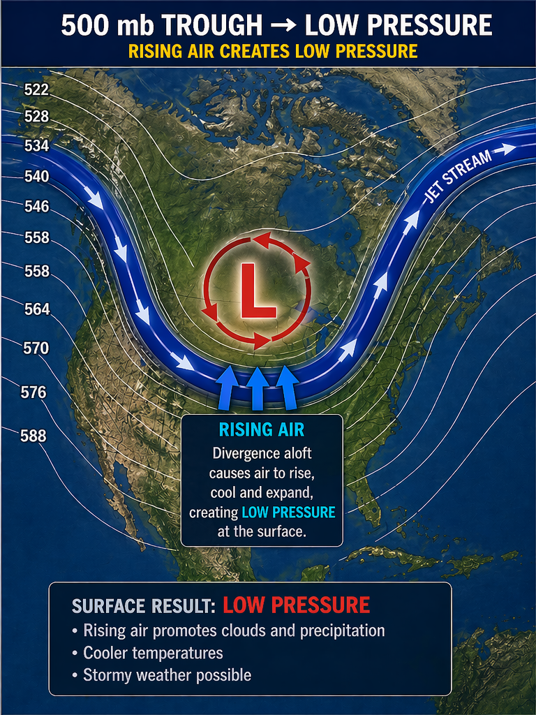
Imagine the jet stream as a river of water. When the river, flowing from left to right, makes a dip, it creates a semi circle flowing counter clockwise. This counterclockwise flow helps to create a full circular motion of water, or in our case air, spinning in a counter clockwise motion, which we call a low pressure system.
The opposite happens when there is what appears as a hill, or northward bulge on the weather map in the mid level jet stream. This up then down flow will help initiate a clockwise motion creating a full rotation, clockwise. We call this a high pressure system.
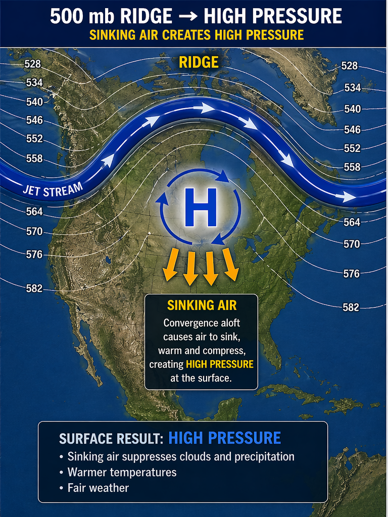
Air in low pressures cause rising air at the surface, and rising air forms clouds and usually precipitation, where air in high pressures creates sinking air which dries the air, evaporating the clouds, giving us fair weather.
So like we said, we have this big hill look, or northward bulge on the weather map in the mid level jet stream which is creating a high pressure over the central portion of the country leading to this incredible stretch of nice weather. Something we deserve after last weeks deluge when over five inches of rain fell in the Fond du Lac area.
The above map is a current look at the jet stream showing the ridge over the central portion of the country, with our next weather making system coming in as a trough over the western US.