Local News
35,000 acres has burned this week in the Los Angeles area. How does that compare with the Fond du Lac area?

The wildfires in the Los Angeles area that have consumed over 5000 structures and killed at least 10 people this week is being reported as burning about 35,000 acres so far, but that may be kind of hard to grasp for anyone not familiar with what that means.
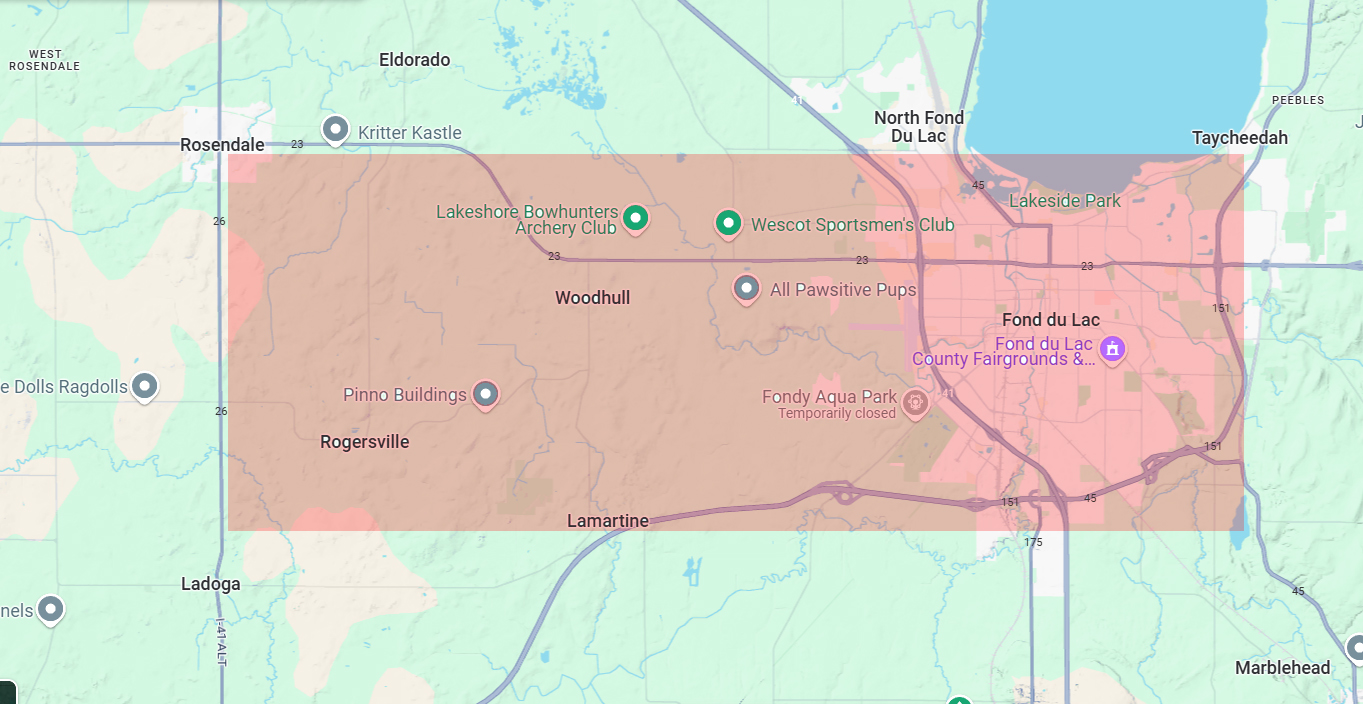
35,000 acres is equal to roughly 55 square miles. That may still be hard to imagine how much land that covers so we’ve laid that amount of land over a map of the Fond du Lac area.
The City of Fond du Lac is about 20 square miles, so the fires are coming close to consuming the amount of land that would be equal to roughly from Highway 151 on the east side of Fond du Lac, and extending all the way to Highway 26 in the Rosendale area.
While much of the area in California is hillsides with few houses, several urban areas have also succumbed to the fire. Again comparing the destruction to the Fond du Lac area, 5000 structures would be about equal to just over 25% of the houses in the City of Fond du Lac being destroyed.


