


Local News
Sunday morning update for potential severe weather outbreak Monday
Is the bark worse than the bite?
This forecast is now outdated. See current forecast here.
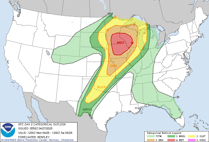
While the Storm Prediction Center paints a picture of doom and gloom, (as does every internet based meteorologist), forecast models have consistently been showing nothing happening in most of the outlook area.
Just about every parameter looks to come together on the models to create powerful, rotating storms, capable of producing large, violent tornadoes, but there is one meteorological phenomenon that is also present to keep it all from happening. The Cap.
Usually, as you go up in height, the temperature cools. If it cools a lot, we call this an unstable atmosphere. So if a parcel of air is heated by the sun at the surface, it will rise into the sky and will rise rapidly in the colder air (warm air rises through cold air) condensing into cloud and creating a thunder storm.
However, sometimes the air gets cooler at first but then there is a warm layer of air a few thousand feet up, and the warm air parcel from the surface is unable to rise through it, as warm air can’t rise through warmer air. We call this layer of warm air a “cap”.
If there is no cap in an unstable atmosphere, we get widespread storms all over the place. If its a medium cap, a strong (extra warm) parcel of air can break through the cap and create an isolated thunderstorm. But if the cap is really strong, no surface parcels are able to break through and we get no storms.
As of now, the latter appears to be the case. Models have been consistent for the last 24 hours with keeping convection (storms) suppressed throughout the day Monday. As a general rule, cap strength weakens as the sun goes down and some of the models do show some storms form after dark or near dusk, but they don’t look very significant and are short lived.
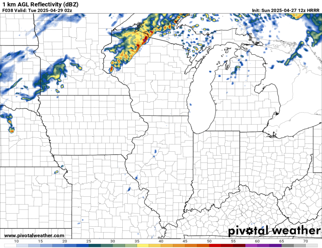
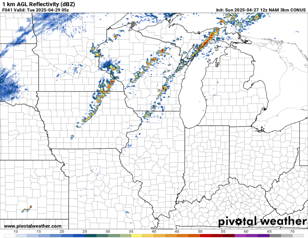
The following graphics are two different models “thoughts” on how things play out. The first is the HRRR model at around 9 p.m. The second is the NAM 3km model around midnight. Neither would be a good indicator of severe weather in our area.
So as of Sunday morning, if you were to have 100% faith in the models, most if not all day Monday will remain severe free for our area. But some meteorologists are thinking the models may be overdoing the cap. This has happened and does happen often where models may ingest a bad piece of data and then that gets extrapolated out in the model’s forecast and it turns out wrong. We’ve all seen that person that shares the map of a model showing us getting 50 inches of snow in the winter but we end up with 10. But I have a hard time excepting this as all the models are in agreement and have been for several runs. Usually if its blamed on bad data, its a one time thing on one of the models.
There is a chance of some mediocre rain/thunder earlier in the day Monday. This is not what all the excitement is about. The scary stuff IF it comes, will come late afternoon/evening, into the overnight.
In closing, don’t go telling everyone “KFIZ says nothing is going to happen”. We’re not saying this. But as of now, models are not agreeing with what the storm Prediction Center is saying. This likely could change if future models reduce the strength of the cap. If that does happen it could be really bad. We just need to wait and see. Regardless, you need to have a plan in place on how you will get your warnings Monday and Monday night and what you will do should severe weather strike your area.