


Local News
Storms rake over state Monday
As was expedited, a round of severe weather went through the area Monday night, April 13, 2026.
A stationary warm front going from southern Minnesota into northern Wisconsin was the focus of storm development in the early afternoon, and those storms congealed into several lines of storms and moved into our area overnight.
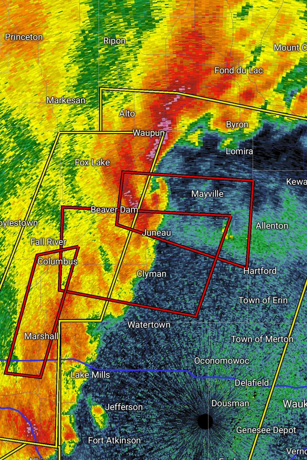
Several severe thunderstorm warnings were issued for the area with a few tornado warnings also being issued.
RIght around midnight, a barn on Highway 26 about 3-4 miles south of Rosendale collapsed from what is being blamed on high winds from the storm.
An estimated 30-40 cows were in the barn at the time with some getting loose, and some being trapped under the rubble. According to the police dispatch call, some of the cows were thought to be deceased.
After that, several tornado warnings were issued for the line of storms. While none of the tornado warnings impacted Fond du Lac County, several were issued for Dodge, Washington and Ozaukee County. Its unknown if any actual tornadoes touched down. Daylight will help landowners see if any damage occurred where rotation was seen on radar.
Ironically, Monday was the first day of severe weather awareness week in Wisconsin, with a National Weather Service storm spotter training class scheduled in West Bend being cancelled due to the impending weather. West Bend would eventually go on to be placed under a tornado warning last night.
Tonight’s program set for Montello will also be cancelled due to more weather being forecasted.
This warm front and associated low pressure that caused all the havoc Monday is still in the state Tuesday and is thought will cause more severe weather to form this afternoon into evening.
Stay tuned to KFIZ’s facebook page and KFIZ radio for up to the minute warnings should any be issued today.