


Local News
How long is this frigid weather going to last?
The coldest temperatures of the year have overspread the area.
Space heaters are working overtime. Our cars are taking forever to warm up, and the air hurts our face when we go outside. Why do we live where the air hurts our face?
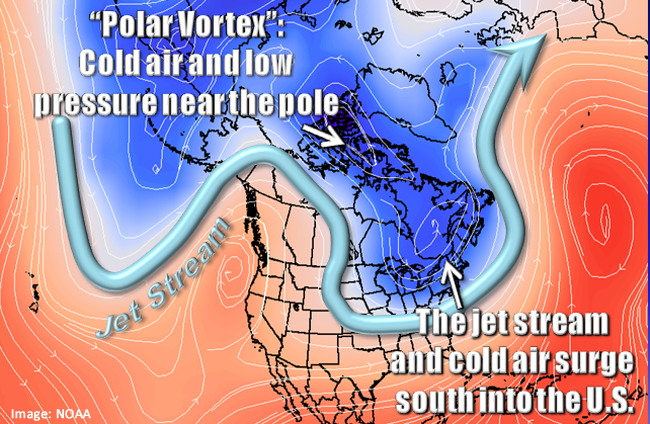
So why the sudden frigid temperatures when the winter has been so mild? You may have heard the term “Polar Vortex” being thrown around. This is the reason, but what exactly is the polar vortex?
The mid level jet stream has a lot to do with how our weather behaves. When it moves straight from the Pacific Ocean to the Atlantic, that is generally associated with calm, or inactive weather. If the jet stream takes a dip, it will likely form an area of low pressure, or a storm system. Here’s where you need to use your imagination. Draw a letter U in the air with your finger. This would represent the dip in the jet stream. So looking at that U, you have sorta formed the lower half of a circle. When the air moves quickly around that dip, the air mass to the north of the dip starts to spin counter clockwise, filling in the rest of that circle and you now have a spinning area of air. If this dip in the jet stream forms around the north central U.S. then this spinning mass of air, or “vortex” happens in Canada, or the “polar regions”, hence polar vortex.
Here is a “sample” of what this can look like…
Here is a map of the current mid level jet stream.
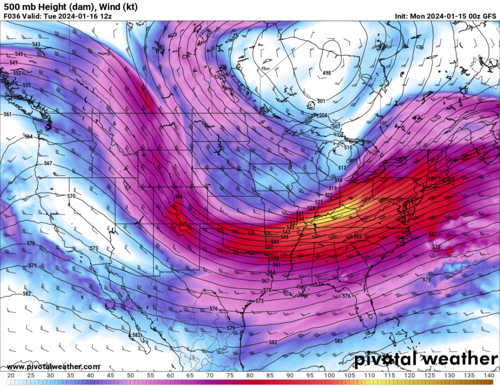
It’s easy to see where the jet stream is. Its the “river” of brighter reds and yellows. All those little dashes with “flags” are how we see wind speed and direction. It’s important to know how to read these to see the direction the air is moving. I’m not going to get into the speeds, but the direction the air is moving is away from the “flag” on these dashes, so the winds in this map are mostly moving from left to right. Another way to see the air direction is the long lines that stretch across the map. The air will be flowing in between those lines. Not across them.
Now look to the north of the dip, all the way up into Canada. Eventually, these winds form a circle, or area of low pressure, and in this map, the center of the circle is right on the Hudson Bay in northern Ontario.
Now that you know how to tell the direction of the wind, look at the air flowing over Wisconsin, and follow it backwards to see where it is coming from. North central Canada, where it is incredibly cold right now. So this air moves down over our area, and we know cold air sinks so that is why it is so cold right now.
So how long will it last? Luckily for us foes of cold weather, the jet stream is already changing patterns in the not too distant future and we will be back to warmer than normal temperatures again.
This is the mid level flow map for Sunday, January 21, 2024.
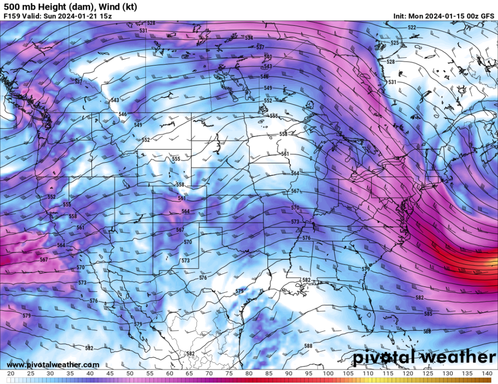
You can see a much weaker jet stream moves way up into Canada, (The very upper part of the map) which allows mid level winds to come into our area from southwest part of the U.S. This will equate to temperatures back in the 30s by early next week.