


Local News
La Nina weather conditions looking likely for winter… what does that mean for us?
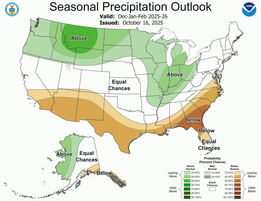
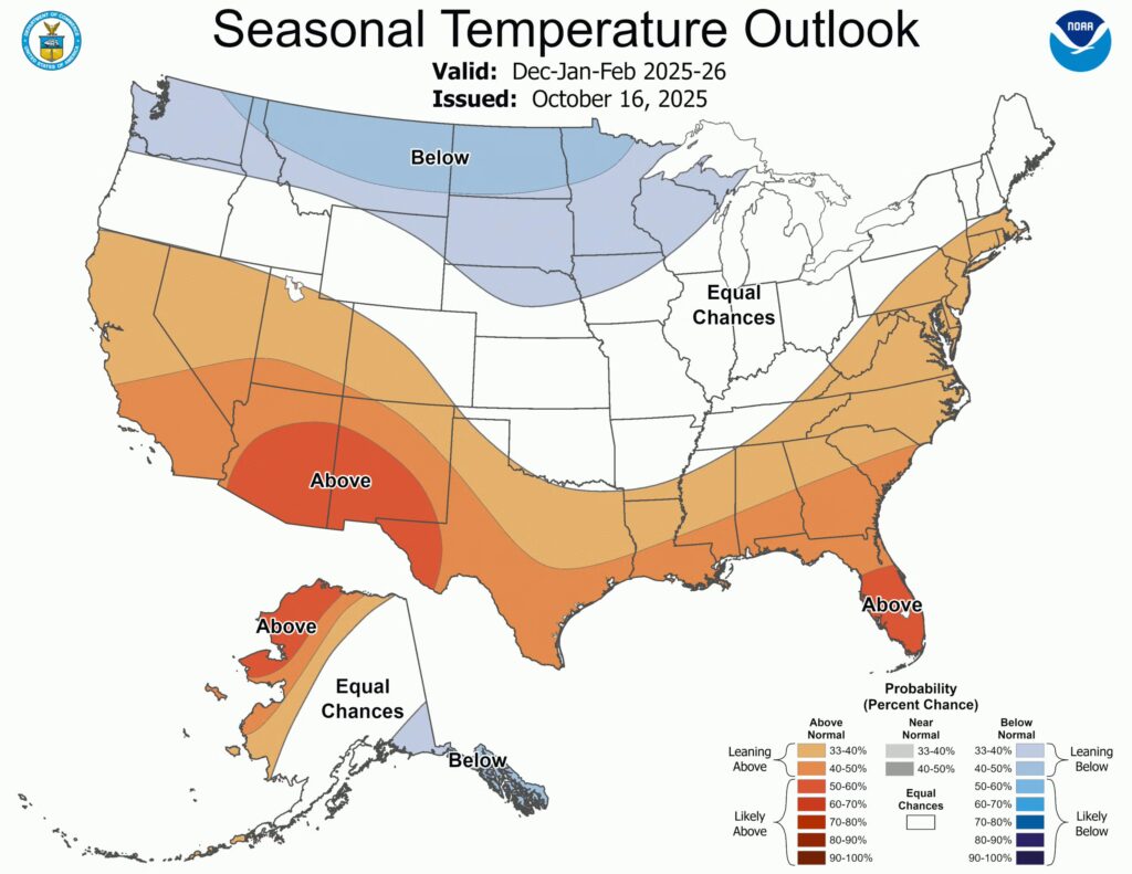
NOAA’s National Weather Service Winter Outlook has been released.
The outlook shows what the likely overall temperature and precipitation will be in the U.S. December 1, 2025 through February 28, of 2026.
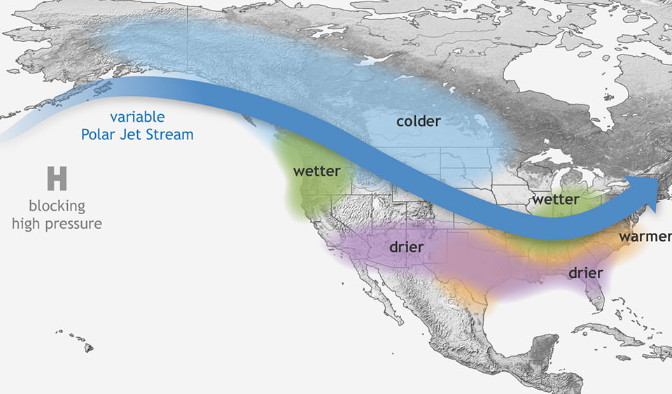
The outlook shows La Niña conditions are expected to develop later this fall and will be a factor in the winter outlook. During La Nina Winters cooler than normal temperatures in the Pacific Ocean alter the jet stream to cause a milder-than-average winter to be favored across the southern tier of the country and along the eastern seaboard, while wetter-than-average conditions for the Ohio Valley and southern Great Lakes region are also favored.
These cold waters in the Pacific push the jet stream northward. This tends to lead to drought in the southern U.S. and heavy rains and flooding in the Pacific Northwest and Canada. During a La Niña year, winter temperatures are warmer than normal in the South and cooler than normal in the North. La Niña can also lead to a more severe hurricane season.
For Wisconsin, the outlook shows near normal to slightly cooler than normal temperatures for Wisconsin with slightly above precipitation chances for the state.
Keep in mind this is an overall outlook and there will be warm spells and cold spells as well as dry periods during the winter months.