


Local News
Late season winter storm to affect much of the country, including Wisconsin, Sunday through Tuesday
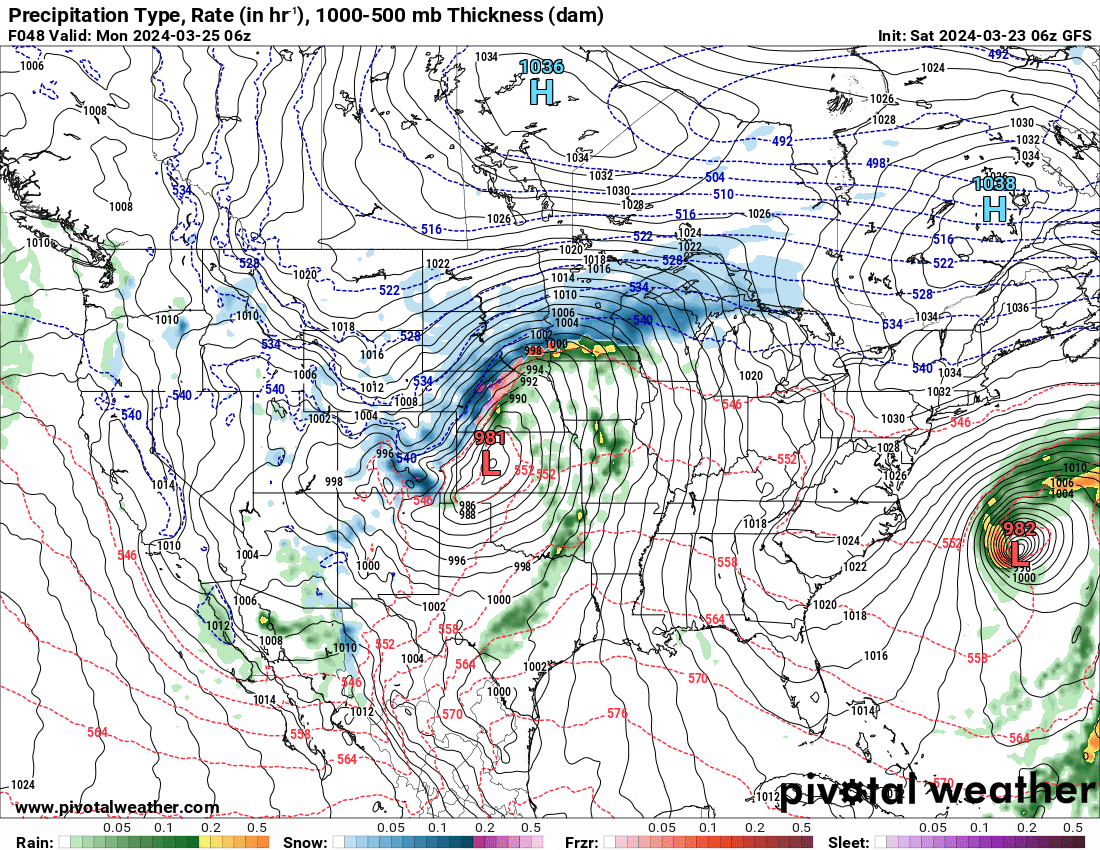
Winter storm watches and warnings are already issued as a major late season winter storm looks to affect much of the nation Saturday through Tuesday.
A strong low pressure area is heading from the central portion of the country, northeast up through northwest Wisconsin and into Canada. Heavy snow is falling from Colorado all the way up through the UP of Michigan, including blizzard conditions in much of Nebraska and parts of Colorado, Kansas and South Dakota.
Here in the Fond du Lac area, the front part of the storm brought snowfall to us Sunday, though much of it didn’t stick and melted as it fell.
Monday, warm air ahead of the approaching center of the storm will come in on southerly winds which will keep any precipitation falling in our area as rain today, before changing back to a rain/snow mix Tuesday evening as the winds switch to coming from the northwest.
Rain totals could get as high as an inch or more in some locations through Tuesday, but any snow that falls on the backside of the storm is not expected to accumulate in the Fond du Lac area.
Northwest Wisconsin from near Eau Claire to near Iron Mountain Michigan is under a winter storm warning Monday. 5-9 inches has already fallen over the area and another 4-8 is expected today
Wind will also be an issue with this storm. Winds will be gusting in the 25-40 miles per hour range from Sunday evening through Tuesday. People driving in high profile vehicles should use caution while winds are gusting.
Stay tuned to KFIZ for any watches or warnings that may come out of this storm for our area, but as of now, none are expected.