


Local News
Nice weather is about to give way to rainy weekend with a threat for severe weather Saturday
A cool start to the day Thursday as a Freeze Warning was issued for Fond du Lac County as well as all of southern Wisconsin for the early morning hours. The temperature at the Fond du Lac County Airport as of 6 AM was 28 degrees which was the low for the day.
High pressure has cleared the skies above us overnight and that allowed what little heating we got yesterday to disperse in the night sky. When there are clouds, they can act as a sort of blanket, trapping the heat in, but with no clouds, that heat rises upward and is replaced with cool air.
High pressure keeps its grip on the area today but as we are now on the backside of the system, winds will be wrapping around from the south which will warm us up a little more than yesterday. Temperatures look to warm into the upper 50s to near 60 today, before dropping again tonight, but not cold enough to drop us below the freezing mark.
Then things take a turn for the worse.
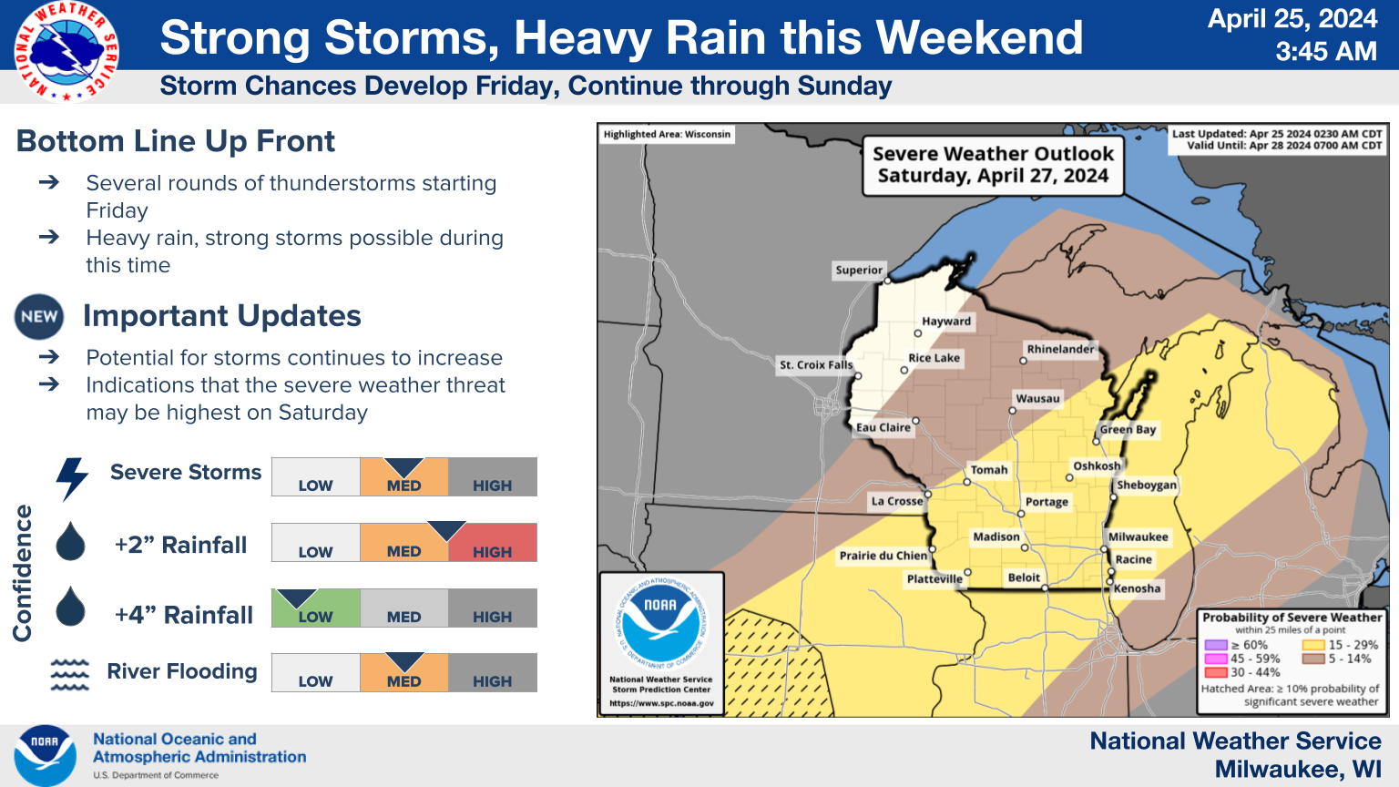
After starting out fair Friday morning, we will see rain move in along with a low pressure storm system moving up out of the central plains states. This rain on Friday wont be much of a concern as the atmospheric dynamics look to be below the threshold for severe weather but that may change on Saturday. As the center of the Low passes just to our north, an interaction with another storm system right behind this one will allow temperatures and dewpoints to rise in Wisconsin Saturday afternoon, and with wind fields conducive of forming rotating thunderstorms, we have the chance to see some hail and a small chance at tornadoes. Right now the Storm Prediction Center has us at a level 2 of their 5 tier system for the forecasted likelihood of severe weather Saturday, though its a conditional threat as we need to see how the rain on Friday and Friday night affects the atmosphere.
Stay tuned to KFIZ.com as we follow this possible severe weather risk for Saturday.