


Local News
Not an April’s Fools Joke… Snow on the way
***UPDATED TO REFLECT HIGHER SNOW TOTALS FORECASTED***
A large area of Low pressure is traversing the middle part of the country today, Monday April 1, 2024, and this will introduce rain to our area this afternoon.
Scattered showers will be possible through this evening then we may see a lull in the precipitation before it picks back up again by morning.
Temperatures will struggle to get into the mid 30s Tuesday so we could see snow for much of the day, but not much will stick to accumulate on the ground.
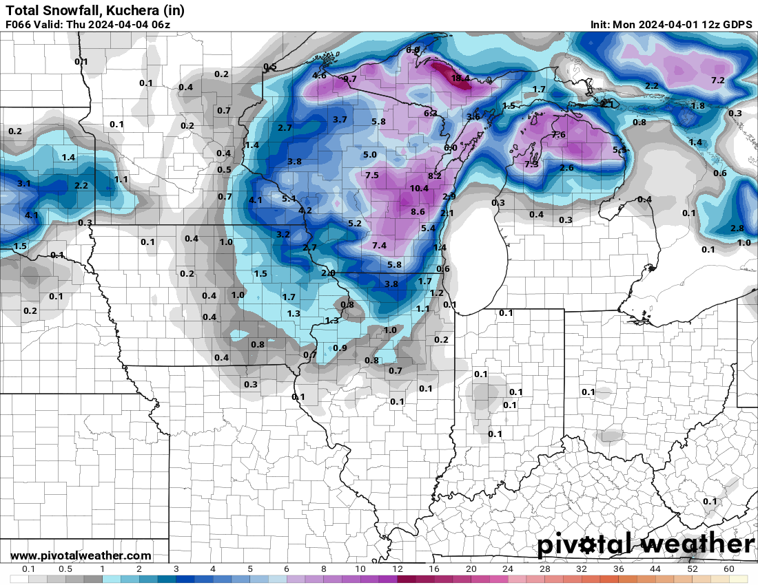
Forecast models show the storm stalling for a brief period to our east in Michigan which could give us a prolonged period of snow and rain through Wednesday night. In total, parts of the area could see about 6-9 inches of wet snow accumulate before its all done. The snow wont stick around for long however as temperatures head back into the 40s Thursday and Friday with sunshine.
FOND DU LAC AREA APRIL WEATHER
Our average forecasted high for Fond du Lac in April is 47 degrees on the first, and that rises to 60 degrees by the 30th. Our record high for the month was 90 which happened April 22, 1980. and our lowest temperature was 3 degrees which occurred April 16, 1904.
The most rain to fall in a day was 2.4 inches on April 3, 1999 and the most snow to fall in a day was 10 inches on April 16, 1921.
And we gain an hour and 22 minutes of sunlight over the course of the month. Sunrise and sunset April 1 are 6:34 AM and 7:21 PM and that extends to 5:46 AM and 7:56 PM on the 30th.