


Local News
Severe weather and flooding possible for first half of weekend
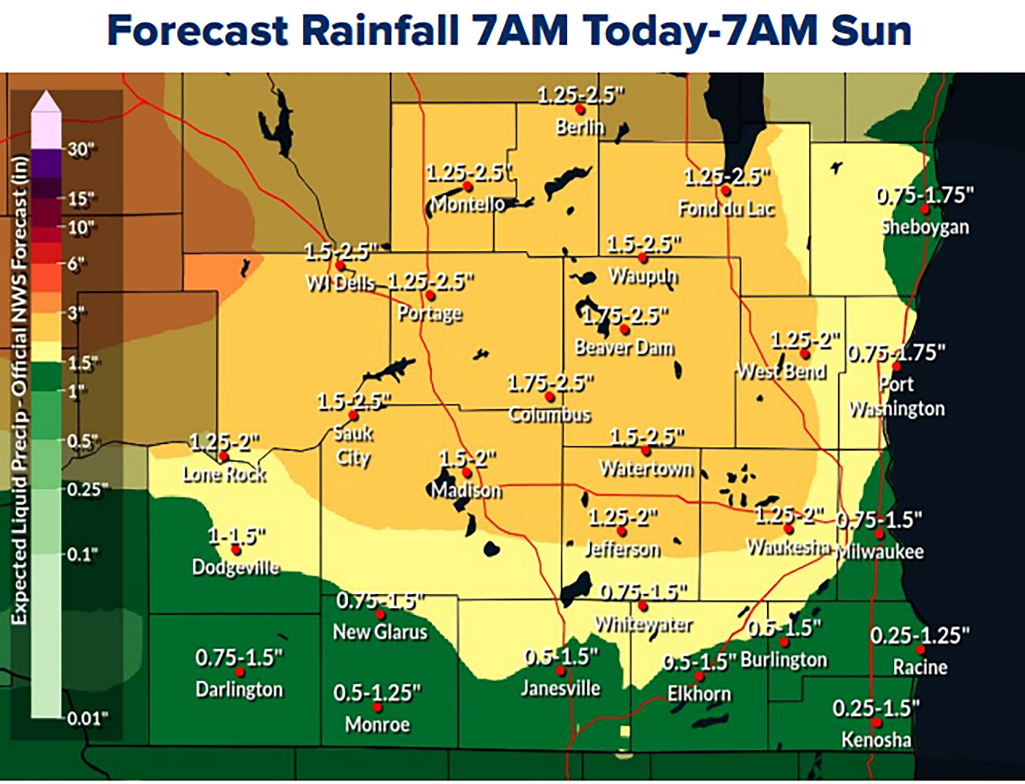
We have some chances for severe weather in the next couple days. Not only will there be the normal severe weather threats of wind, hail and an isolated tornado, but heavy rains will also pose a flooding risk as well, and Fond du Lac County is included in a handful of Wisconsin counties under a flood watch Friday and Saturday.
Officially a flood watch is in effect from 2 this afternoon through tomorrow evening.
The National Weather Service says multiple rounds of heavy rainfall are expected beginning this afternoon and lasting into early Saturday evening.
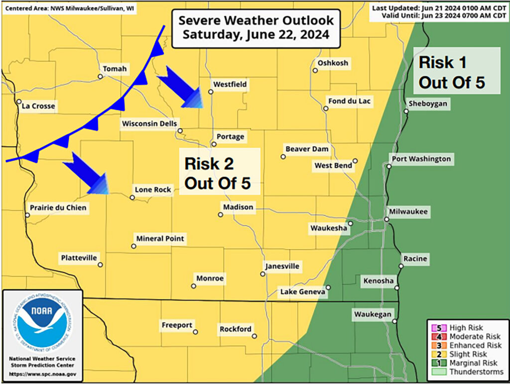
The Storm prediction Center has western Wisconsin under a slight risk of severe weather this afternoon. A level 2 of their 5 level system, with the Fond du lac area under a marginal risk, or level one on their risk chart. Tomorrow however that slight risk moves east so as of now, we will be in the slight risk area for severe weather tomorrow.
This is all in response to a subtle low pressure system working its way into the region at the surface, coupled with an upper level disturbance that will bring cold air aloft. When this happens, we get favorable conditions for thunderstorms, and in areas near where fronts, or wind shift lines set up, these storms can grow to be organized storms with severe winds, hail and maybe even a small, brief tornado.
Right now the threats for the severe weather are on the lower side, but the heavy rains are more of a likelihood as this system pushes through. As of Friday morning, most of the models are showing widespread areas of 1.5 to 2 inches of rain falling over the area through Saturday night.