


Local News
Severe weather potential for Thursday? Here’s how forecast models look three days out
Conditions appear to be coming together for at least a scattered round of severe storms Thursday afternoon, May 15, 2025.
Synoptically, an intensifying low pressure storm system looks to move northeast out of the central plains into Minnesota as it strengthens during the day Thursday.
Winds from the south out ahead of this system will usher in moist, unstable air, with dewpoints in the mid 60s stretching into Wisconsin Thursday afternoon.

A key ingredient for organized storms is a strong mid-level jet stream, overlaying winds out of the southwest above surface winds out of the south which appears to be occurring during the time of peak heating in our area. Heating of the surface air is another key component for storm development. Parcels, or bubbles of air at the surface, heat up and rise. These parcels of rising air then condense into storm clouds which are then shaped into organized rotating storms by the forementioned winds aloft.
Forecast models can take these different conditions and create a numerical equation that can be output into a composite to show the risks of supercell thunderstorms (the ones that rotate) and also tornado threats. With data that was initiated Tuesday morning, models show a narrow tongue of favorable conditions for tornadoes and supercell storms in the Fond du Lac area Thursday afternoon.

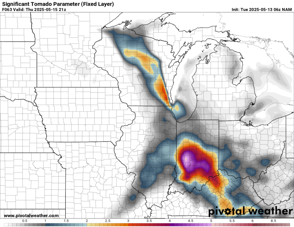
While these parameters are not off the charts, they do show the risk for at least scattered storm development.
Now don’t panic or get stressed out with this information. Even IF this forecast were to verify three days out, which is unlikely this far out, storms that would produce severe weather would likely be scattered, so the chances of a storm actually affecting you is slim. But on that note, don’t disregard the risk all together. Use this information to plan ahead what your steps would be to keep you and your family safe should severe weather actually move into the area.
KFIZ will continue to monitor this potentially dangerous situation and update the forecasted threats daily up through the time storms look to form.