


Local News
Thursday night forecast for Saturday snowstorm

A low pressure storm system is forecasted to develop over the next few hours over the Wyoming/Montana area and over the next 36 hours, it will intensify slightly and drift southeast to the Oklahoma area.
This path is significant when you realize that winds flow counterclockwise around low pressures, so as this system digs to the southeast, the winds out in front of it will gather and transport gulf moisture from the southern states, north into the Great Lakes area, where rising air in the low pressure (That’s why it’s called a low pressure, because the air is rising up from the surface. While hard to believe, air does have weight and this weight applies pressure to us. If the air is lifting up, that means some of the weight is being lifted off us, creating lower pressure… hence a low pressure system. High pressures are the opposite. The air sinks creating more pressure at the surface.) condenses the moisture forming clouds and precipitation which at these temperatures will be snow.
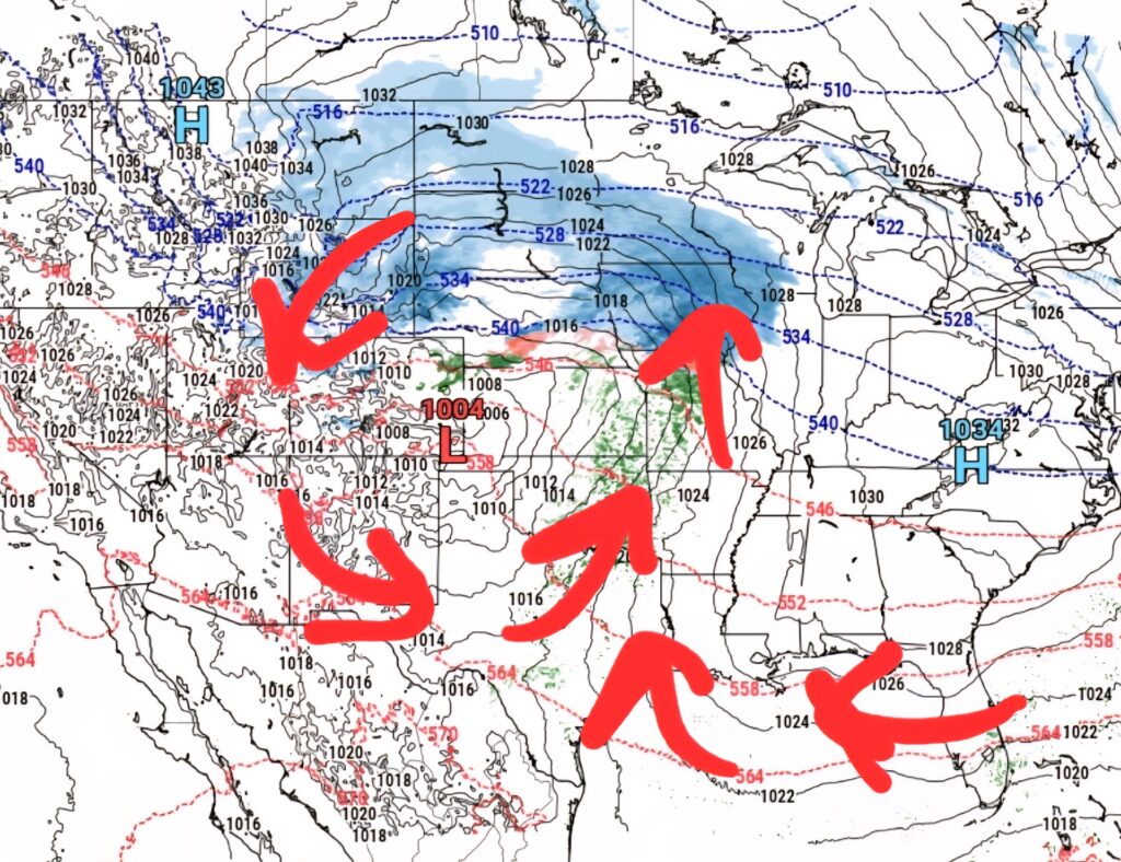
After hitting the Oklahoma area, the low pressure turns or “hooks” to the northeast and heads towards the Great Lakes. This is what we call a “Panhandle Hook” as it drops to around the Texas and Oklahoma Panhandles and then moves north, dragging all that added gulf moisture with it. Panhandle Hooks are the types of winter storms that give us the heaviest snowfalls.
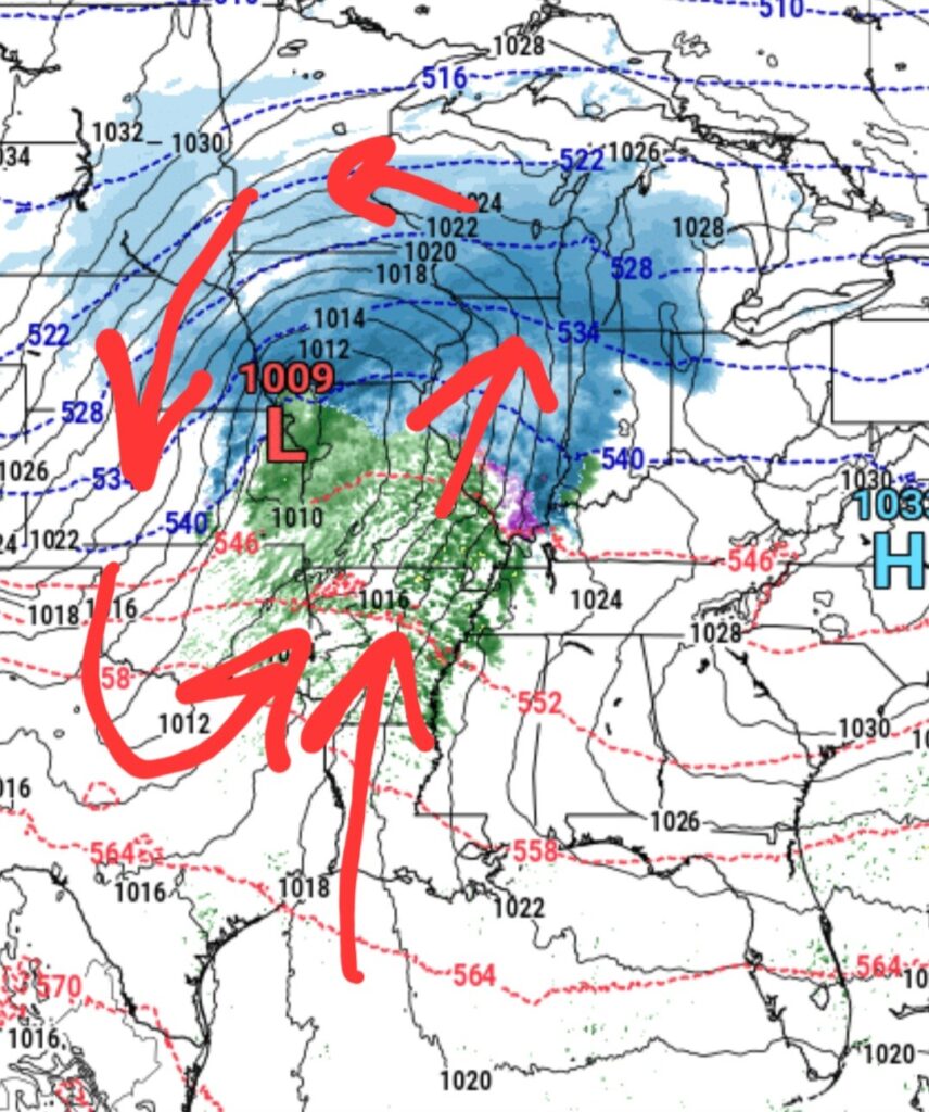
Up to this point, this is the broad, or larger picture of the forecast. Things get a little harder to forecast after this point, because the roughly 50-100 mile width of the center of the low has the most dynamics of the storm which vary greatly. For instance, 30 miles south of the low’s center will be warmer and may see more rain then snow whereas the area 30 miles north of the low tends to be where the largest snow totals fall, so the slight wobble of the low’s center only a county or two after a forecast is made could change the forecast drastically.
Models as of Thursday afternoon are showing the center of the low passing from a St. Louis to a Chicago line, which places the heaviest snowfall in southern Wisconsin, closer to the state line, with, while not as heavy, still significant totals north to the Fond du Lac area.
This looks to be a longer duration snowfall, starting Saturday morning and ending Sunday morning with the heaviest snow falling Saturday evening. At this time, with no deviation of the low’s track, this would likely give the Fond du Lac area 5-7 inches of snow.
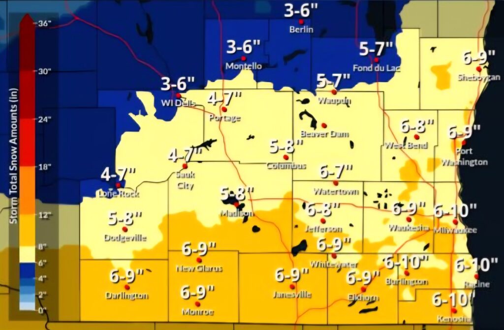
IMAGE COURTESY OF NATIONAL WEATHER SERVICE SULLIVAN
As the low moves closer to the relatively warmer waters of Lake Michigan, and wind flow to the north of the low’s center has an easterly componant to it, that added moisture coming off the lake could add slightly to totals near the Lakeshore. This could up totals there an inch or two, with far eastern Fond du Lac County even seeing a little more from the lake enhanced snow.
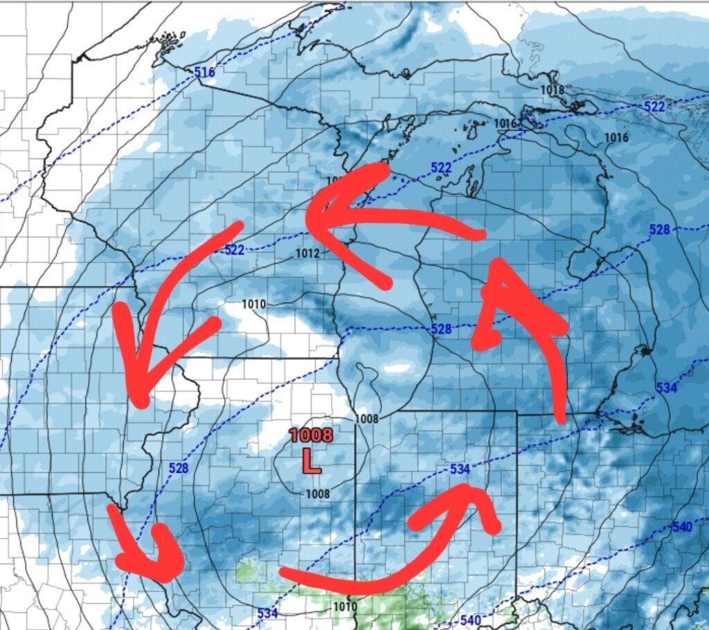
As always, winter snowfall is dependent on the track of the low, so this forecast is in no way set in stone. KFIZ will update this forecast Friday evening.