


Local News
Tornado warnings for Fond du Lac County, damage reported in Dodge County
Severe weather raked through the area Thursday afternoon, May 15, 2025, as a potent low pressure storm system passed over Wisconsin.
Storms initially formed in a line from central Minnesota down through southwest Wisconsin. These storms in southwest Wisconsin were moving northeast towards Madison and quickly went severe with one near Baraboo going tornado warned.
Large hail up to two inches in diameter was reported with many of these initial storms.
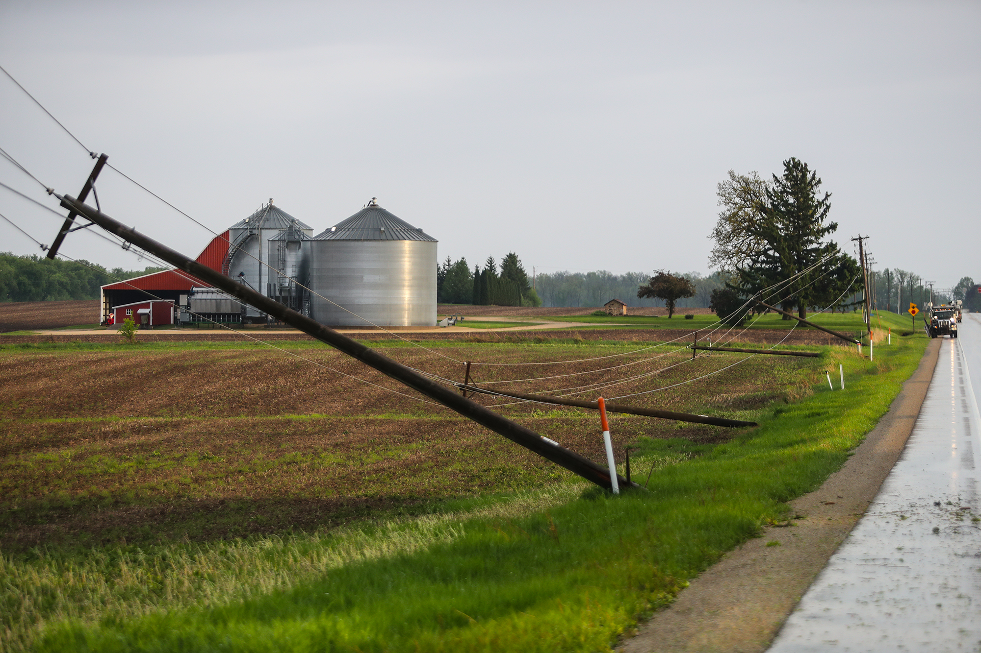
As the storms continued northeast, one of them started rotating as it entered Dodge County southeast of Columbus. The National Weather Service issued a tornado warning for the storm, and About 15 minutes later, significant damage was being reported in Juneau, Horicon and Mayville.
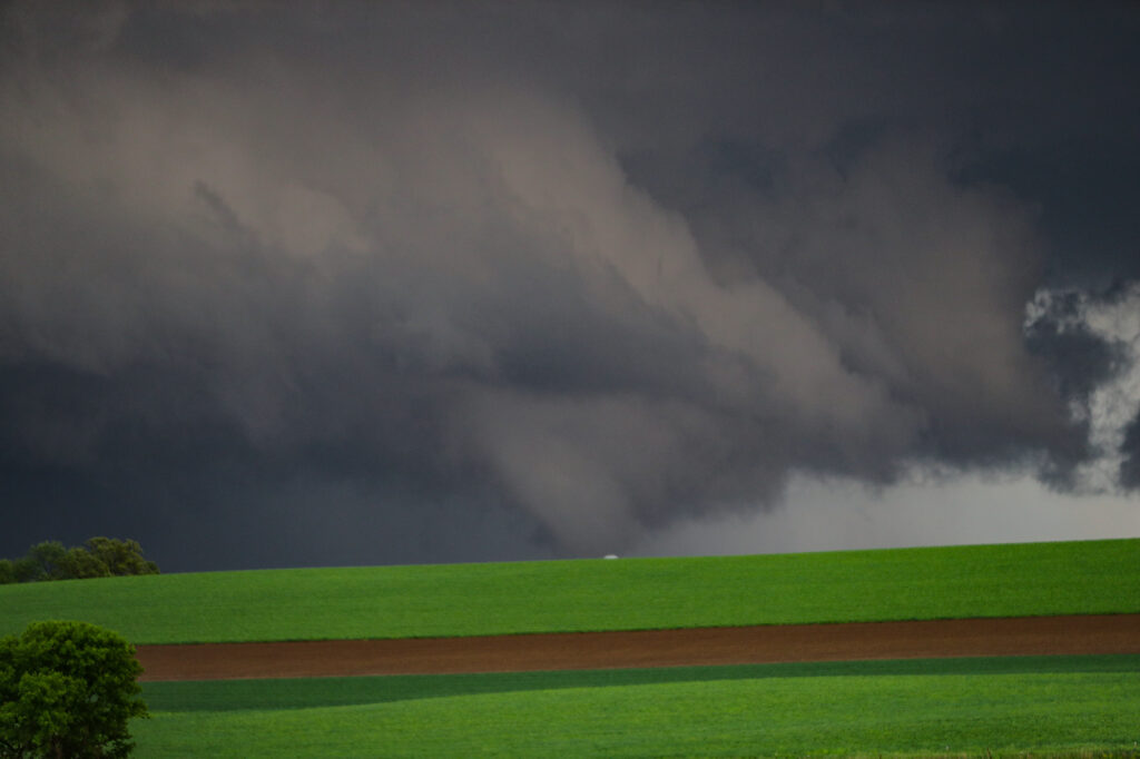
In Juneau, roads were blocked by fallen trees and wires with a few trees causing damage to houses they fell on. At least a couple buildings in Juneau were also damaged by wind as well as a barn nearby which had a silo tipped over. Mayville seemed to get it worse with a tornado confirmed there by video. Several buildings including Mayville Engineering were badly damaged.
Dodge County Sheriff Dale Schmidt issued a press release asking those not from the affected cities to not come to look at the damage as this was clogging up already congested roads.
In Fond du Lac County, the storm continued to be tornado warned into the Campbellsport area but no damage has been reported.
Two other storms prompted tornado warnings for Fond du Lac County around the same time. One entered the southwest part of the county north of Waupun, and another affected the Ripon area. No significant damage was reported in those areas.
By 8 PM the storms had moved east of the area. In total, there were about a half dozen tornadoes reported in the state as well as dozens of large hail and high wind reports.
The National Weather Service will be out Friday assessing the damage in Dodge County.