


Local News
Tornado watch issued for Fond du Lac area second day in a row
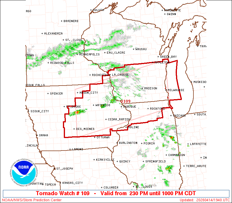
The NWS Storm Prediction Center has issued a

   * Tornado Watch for portions of
     Central and Eastern Iowa
     Northern Illinois
     Extreme Southeast Minnesota
     Southern Wisconsin
     Lake Michigan

   * Effective this Tuesday afternoon and evening from 230 PM until
     1000 PM CDT.

   * Primary threats include...
     Several tornadoes and a couple intense tornadoes likely
     Widespread large hail and scattered very large hail events to 4
       inches in diameter likely
     Scattered damaging winds likely with isolated significant gusts
       to 75 mph possible

   SUMMARY...Supercell thunderstorms will pose a threat for very large
   to giant hail this afternoon and evening as they track eastward,
   with the largest hailstones potentially reaching up to 3-4 inches in
   diameter. The threat for several tornadoes will increase later this
   afternoon and evening along a warm front, and any sustained
   supercell will be capable of producing a strong tornado. Otherwise,
   scattered to numerous severe/damaging winds may eventually occur as
   thunderstorms consolidate into one or more bowing clusters, with
   peak gusts up to 65-75 mph.

   The tornado watch area is approximately along and 75 statute miles
   north and south of a line from 60 miles west southwest of Waterloo
   IA to 20 miles north northeast of Milwaukee WI. For a complete
   depiction of the watch see the associated watch outline update
   (WOUS64 KWNS WOU9).

   PRECAUTIONARY/PREPAREDNESS ACTIONS...

   REMEMBER...A Tornado Watch means conditions are favorable for
   tornadoes and severe thunderstorms in and close to the watch
   area. Persons in these areas should be on the lookout for
   threatening weather conditions and listen for later statements
   and possible warnings.