Local News
Warm Winter Weather Fans Rejoice As Strong El Nino Forecasted To Last Into Spring
An El Niño weather pattern looks to hold strong this winter according to the latest long range forecast from the Climate Prediction Center.
But what exactly is El Niño and how is it going to affect our weather you ask?
The short and simple definition is warmer than normal waters in the southern Pacific Ocean off the west coast of North America modify our normal winter weather by causing the Pacific jet stream to move south of its neutral position. With this shift, areas in the northern U.S. and Canada are dryer and warmer than usual. But in the U.S. Gulf Coast and Southeast, these periods are wetter than usual and have increased flooding.
While meteorologists knew the early winter would show signs of an El Niño, temperatures in the Pacific have warmed even more in the last month ultimately increasing the strength of this El Niño event to what scientist say could become historically strong.
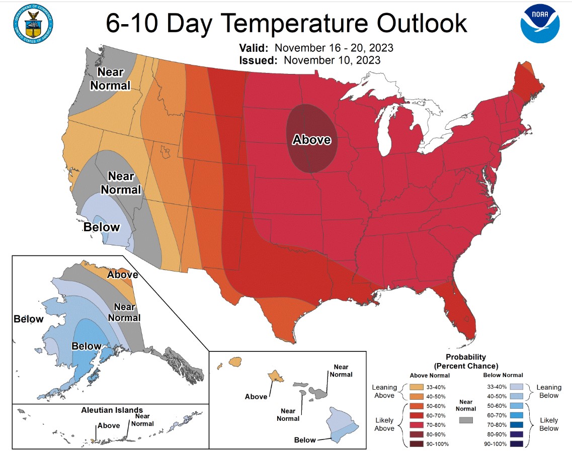
In summary, El Niño is anticipated to continue this winter in the Northern Hemisphere, with a 62% chance of it continuing into the April-June 2024 time frame. This means a continued warmer and dryer than normal winter and spring. Evident short term in our 6-10 and 8-14 day temperature outlooks issued by the Climate Prediction Center.