


Local News
Wednesday afternoon update for severe weather outlook for Thursday, May 15, 2025
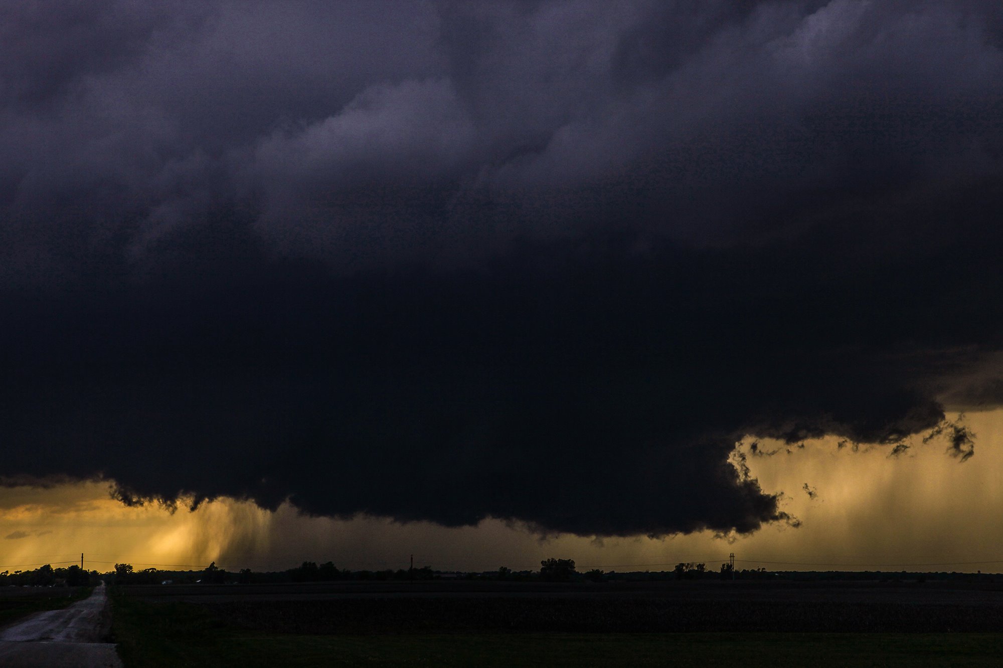
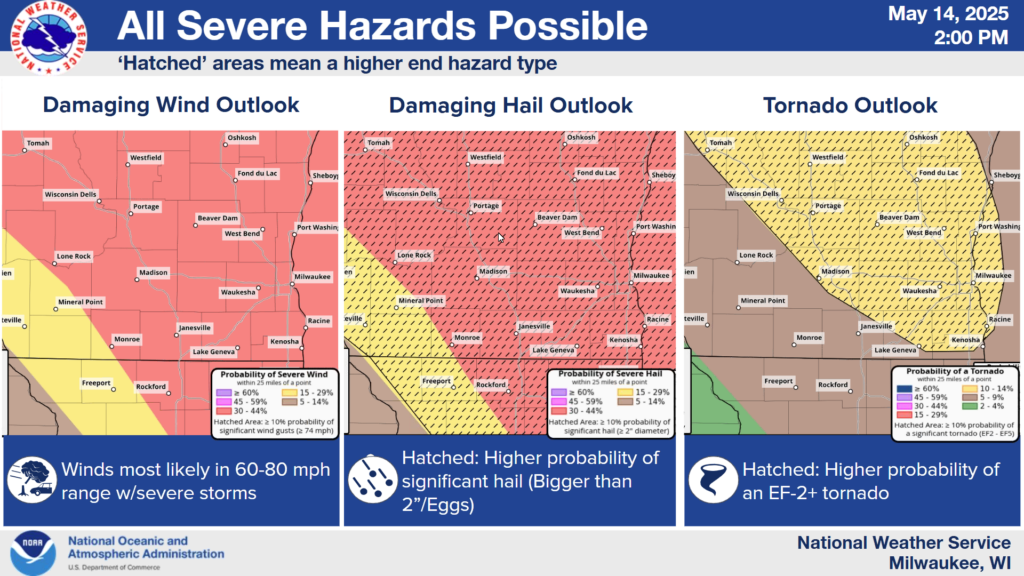
Things continue to look favorable for a severe weather outbreak in central and eastern Wisconsin for Thursday, May 15, 2025.
At this time, all severe weather threats look possible where storms pass over, including the risk of a strong tornado and large hail.
As for a breakdown in dynamics… We have an approaching, strengthening low pressure storm system which will be moving northeast out of the South Dakota area into central Minnesota during the day. This will allow a warm, moist airmass to build in place over much of Wisconsin during the day Thursday. This creates an unstable airmass as the air aloft will not only be colder, allowing for the warm moist air to rise, forming thunderstorms, but the winds aloft will be conducive for rotating storm updrafts which will be favorable for the formation of large hail and tornadoes.
Favorable windshear occurs when the winds turn clockwise with height and increase in speed. So for instance, the winds at the surface are blowing out of the south at 15 mph. A few thousand feet up they are blowing out of the southwest at 30 mph and a few more thousand feet up they are blowing out of the west at 50 mph. Going from south to west equates to 90 degrees of turning out of a 360 degree circle.
While that alone is ample enough shear for severe storms and tornadoes, we add another component into the mix and that would be a lake breeze off Lake Michigan. Lake breezes blow inland with a wind off the lake from the east. These winds are cooler, and will for the most part help to stabilize the air along the lakeshore counties, helping to reduce the severe weather threat there. However, where the boundary of the breeze ends up, will enhance the wind shear. This will be because where the wind WAS from the south, it is now blowing from the east from the lake breeze. With the winds turning aloft from the west, this now creates 180 degrees of turning. Twice as much as what was already there. This has the potential to amp up a tornado threat where the forward side of this lake breeze sets up. That appears to be over or near the Winnebago through Washington County area, cutting right through Fond du Lac County.
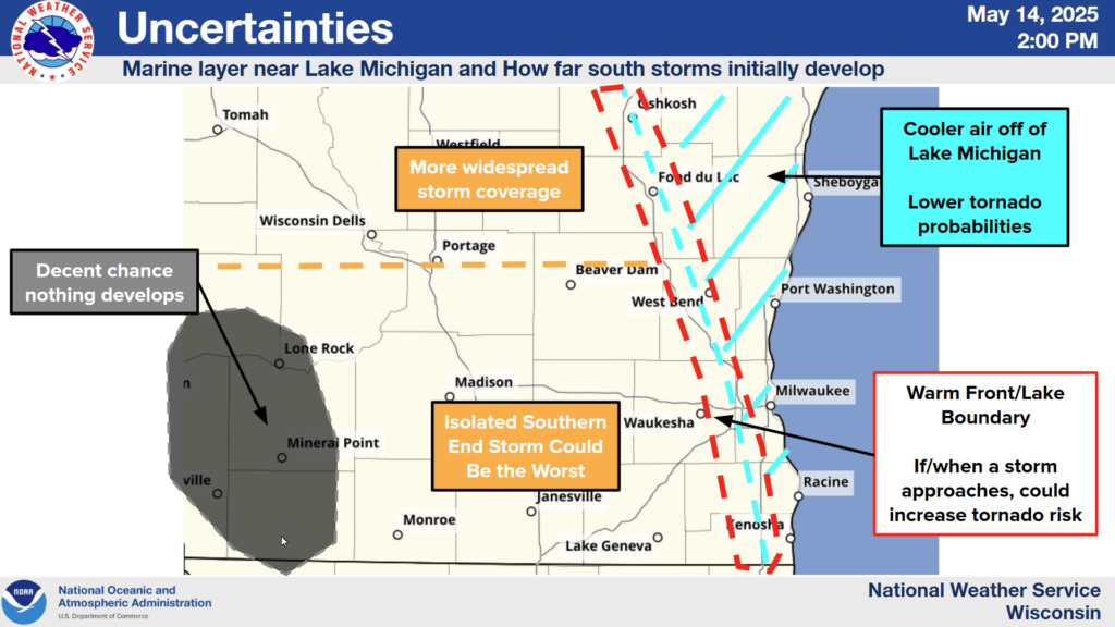
Many of us may have cry wolf syndrome from the last severe weather threat that went through the area a couple weeks ago when nothing happened. Again there was to be a significant tornado threat with that system. What makes this one different is the main dynamics in the last storm were a couple hundred miles west of us, but there was a chance things could extend this far east. Things never really materialized as what could have been because there was one fly in the ointment. A cap, or a very warm layer of air aloft that kept storms from forming.
This time looks to be different, as the area of most concern is right over us… not a couple hundred miles away, and not only is the cap much weaker with this system, the forcing that will drive the updrafts into the cap will be much stronger, allowing for the cap to be easily breached.
So when is all this doom and gloom supposed to happen? Glad you asked. Storms look to form along and either side of the Mississippi River in the 2 PM to 4 PM time frame and storms will move and build east into our area in the 4-6 pm time frame. Storms should be quickly moving east out of the area by 8 PM giving us a quiet night with clearing skies and a comfortable sleeping temperature in the mid to upper 50s for a low.
As always, stay tuned to KFIZ’s Facebook page for up to the minute watches and warnings and possibly a live update from the field from our very own Doug Raflik.