


Wisconsin News
Wisconsin DOT Release Archived Wisconsin Road Maps
The Wisconsin Department of Transportation has released an online archive of Wisconsin’s Official State Highway Map over the past 100 years.
The first edition of the state highway map was printed in 1918.
WisDOT Secretary Craig Thompson said. “We hope Wisconsinites, visitors and history enthusiasts enjoy this fun opportunity to look back through time and explore the changes to our transportation infrastructure.”
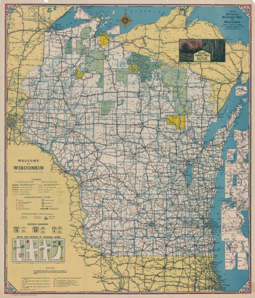
The first few map publications in the 1920s served as a guide of the state road network and sold for 10 cents per copy. By the 1930s, maps were distributed for free to the public with a new emphasis promoting travel and tourism for residents and visitors to enjoy Wisconsin.
Today’s map includes the highway map data and creative content developed by WisDOT and the Wisconsin Department of Tourism.
Wisconsin’s Official State Highway Map is still distributed free to the public. Even in a world with increasing options for GPS and electronic wayfinding service, demand for the latest version of this 100-year-old paper map remains high. It’s distributed through the Wisconsin Department of Tourism, visitor centers, rest areas, gas stations, and other businesses and organizations throughout the state.