


Local News
More snow on the way with cold air to continue after brief warm-up
A pair of clipper type systems, or fast moving, generally low precipitation producing storms moving southeast out of Canada, look to pass over Wisconsin the next couple days.
The first to move in will be Monday night, December 8, 2025, but only a dusting of snow is forecast to fall.
Attention then turns to towards the second system which is looking to move in starting Tuesday night. This storm looks to be pretty strong as clippers are concerned and because of this, does have the potential of producing some heavier snowfalls.
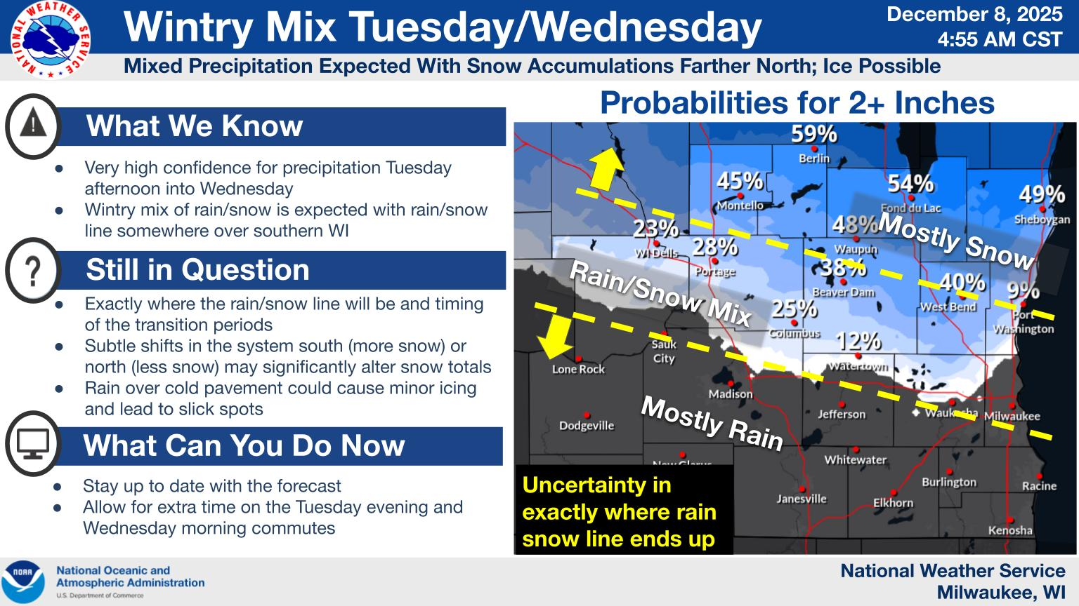
Models show the bulk of the snow to fall just to the north of Fond du Lac County with Winnebago County and points north under a winter weather advisory.
2-4 inches is likely across the Fox Valley with lighter amounts around Fond du Lac and heavier amounts in the Appleton area.
This could change slightly however as the storms exact path is still not completely known.
What is known however, is that bitter cold air looks to move in once the second storm has passed with sub 0 readings expected Saturday and Sunday nights.