


Local News
Record El Nino still on track this winter
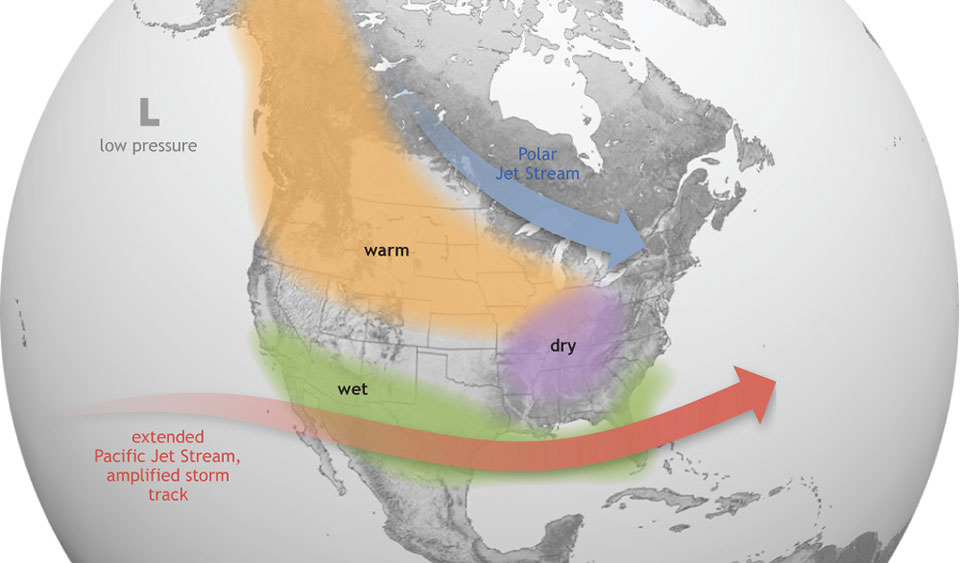
Climate experts say a strengthening El Niño is still on track to become one of the most significant in decades, with widespread impacts on weather around the globe through this winter.
The United Nations’ World Meteorological Organization says there’s now a 97 percent chance El Niño conditions will continue into the spring of 2027, with an 81 percent chance the event reaches “very strong” status during the fall. If those forecasts hold, it could rank among the strongest El Niño event recorded since 1950.
El Niño develops when unusually warm water spreads across the central and eastern Pacific Ocean, altering weather patterns around the world.
A strong El Niño typically pushes the polar jet stream farther north, allowing milder Pacific air to dominate much of the northern U.S. States including Wisconsin, with the Upper Midwest often seeing above-normal temperatures, especially during the second half of winter.
Historically, strong El Niño winters tend to average 2 to 5 degrees warmer than normal across Wisconsin. That doesn’t mean there won’t be bitter cold snaps—but they’re often shorter and less frequent.
“While El Niño doesn’t eliminate winter in Wisconsin, it often takes the edge off. We can Expect fewer prolonged Arctic outbreaks, more days hovering around the freezing mark, and an increased chance of messy mixed-precipitation storms instead of all snow. Once we head into spring, forecasters will be keeping a close eye on the potential for a more active severe weather season.”