


Local News
Storms today could be severe. All severe hazards are possible in stronger storms.
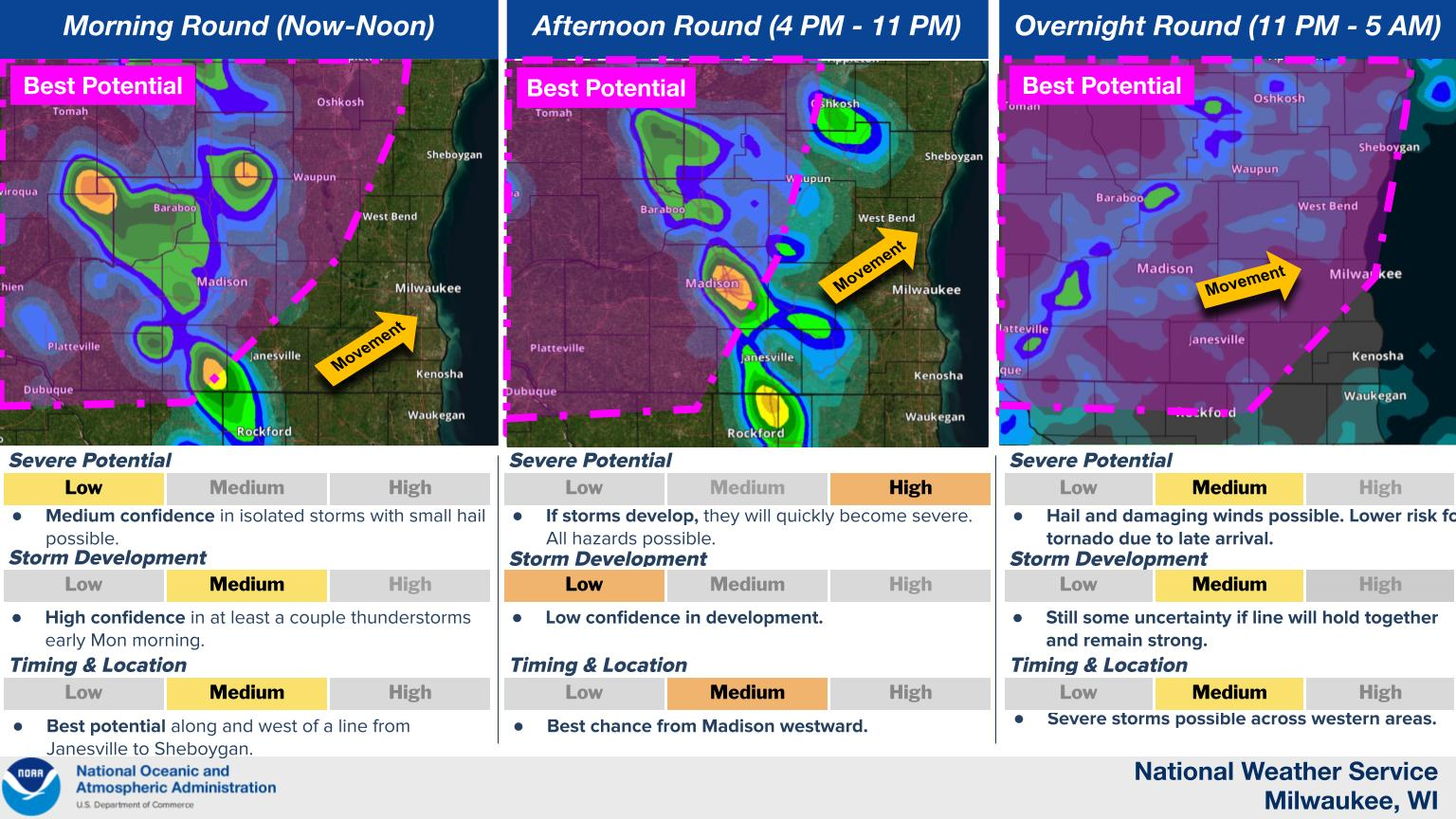
A severe weather outbreak is forecasted across the region today but fortunately for us, the chances here are far less than a state west of us. This doesn’t mean however that we won’t get anything.
Parameters for severe weather are maxed out during the peak heating hours of 6-8 pm in north central Iowa and south central Minnesota, but storms could pop up anywhere in what’s called the warm sector of the system.
The warm sector is the area of warm air behind, or south of the warm front. Our area will be on and south of the warm front for a majority of the afternoon time frame. This is when there is a chance of storms to form, but the conditions that will be conducive for tornadoes will be more to the west in western Wisconsin, Minnesota and Iowa. We could see some strong winds and hail with these storms but a tornado or two could also be possible.
A better chance of storms will come after dark when a cold front will sweep over the area, likely bringing a line of storms with it, as well as a better environment for rotating storms. Forecast models show the energy in the atmosphere to be much weaker here however than it was to our west so storms should be declining in severity but will still have the potential to be severe and rotating as they pass over tonight around and just after midnight.
Stay tuned to KFIZ’s Facebook page for up to the minute watches and warnings today, as well as on KFIZ as warnings will air from the National Weather Service as they are issued.