


Local News
Tornadoes in the forecast? There is a small chance Friday night

Friday morning, March 6, 2026, starts out with an area of moderate rainfall coming up from the southwest on a warm front, associated with a low pressure storm system centered over the Nebraska/Kansas area.
We’ll see areas of rain throughout the day with a break coming in the evening hours before another round of rain moves in overnight. This second round of rain will likely contain some stronger storms, with the Storm Prediction Center even calling for the chance of some severe weather including a possible tornado or two.
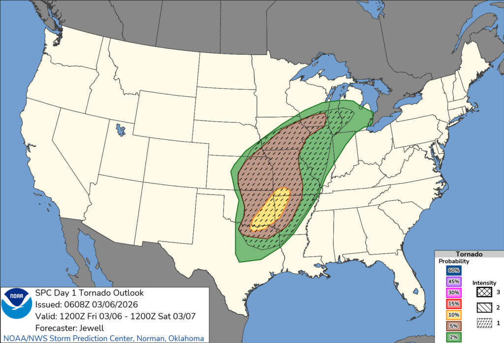
The chance for tornadoes increases as you head southwest, though its not out of the question, with the amount of wind shear, or turning of wind with height, that some rotation could be realized in a stronger storm, should one pass over the Fond du Lac area.
The more pressing concern by Friday night will be low lying ponding of water as some areas have the potential of seeing 1-2 inches of rainfall. With the ground still frozen, this water will have nowhere to go but to pool up in low lying areas.
Stay tuned to KFIZ’s Facebook page Friday night for up to the minute watches and warnings should conditions continue to bring a round of strong to severe storms through the area.
Rain should be moving out of the area Saturday morning as a cold front on the backside of the system pushes through.